-
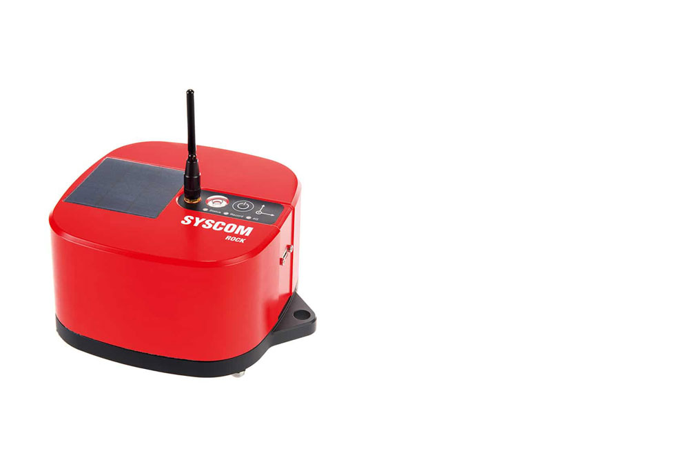
SYSCOM'S ROCK
-
VIBRATION MONITORING AND INSTRUMENTATION
Modern technology, reliable and cost effective for a safe environment
-
-
-
-

OUR INNOVATIVE APPROACH GUARANTEES THE RIGHT SOLUTION THROUGH OUR BROAD EXPERTISE IN APPLIED GEOPHYSICS
At Geophysics GPR International Inc. we are committed to innovating in applied geophysics. Through our knowledge and ability to apply traditional and innovative geophysical methods, we solve geologic, geotechnical, engineering and mining challenges.
We are inspired by the idea of providing you with the widest range of solutions adapted to your needs in order to deliver the best data available in today's market.
LET GPR'S EXPERTISE WORK FOR YOU
OVER 50 YEARS
SOLVING GEOLOGIC, GEOTECHNICAL AND ENGINEERING CHALLENGES
THE WORLD OVER
North America / Latin America / Africa / Asia
ground geophysics
Geological and geotechnical studies
- Overburden and bedrock mapping
- Shear wave velocity measurements (Vs30)
- Soil and rock properties
- Subsidence, void and karst mapping
Civil engineering and infrastructure projects
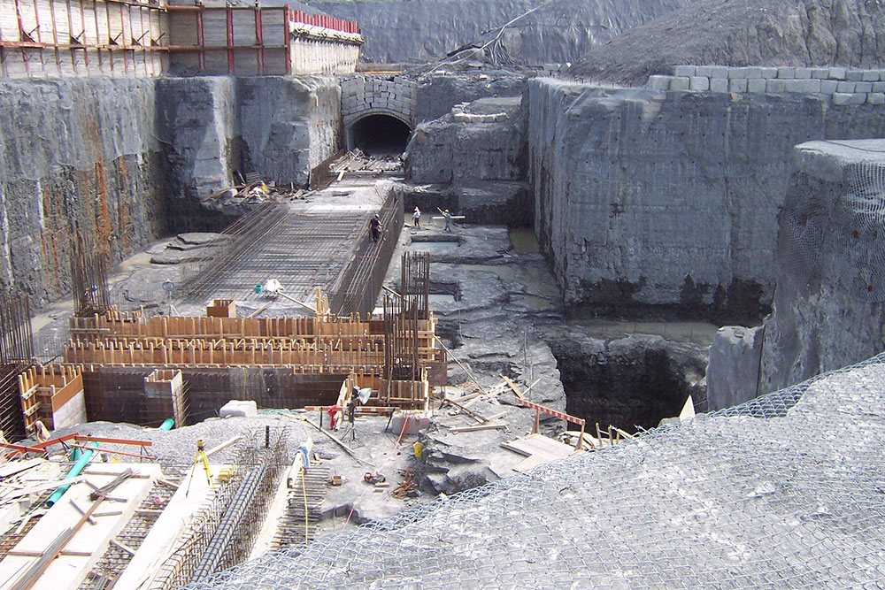
- Dam and tunnel investigations
- Road and bridge inspections
- Concrete structure evaluationRebar mapping
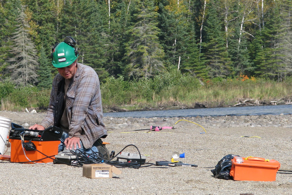
- Vibration monitoring
- Non-destructive testing (NDT)
Environmental investigations
- Buried infrastructure mapping (UST's)
- Pipe and conduct location
- Contaminant and plume mapping
- Landfill delineation
- Leak detection
Mineral, oil and gas exploration
- Ore deposits
- Coal deposits
- Natural gas and oil reservoirs
Mining engineering
- Tailing pond studies
- Dam studies
- Waste rock pile studies
- Seismic event monitoring
- Vibration monitoring
- Blast pattern design
Hydrogeology
- Fractured rock imaging
- Groundwater target optimization
- Aquifer delineation
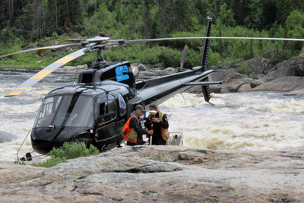
AIRBORNE & HELIBORNE GEOPHYSICS
Mineral, oil and gas exploration
(magnetometry, spectometry, GPRTEM, VLF)
Airborne bathymetry
Geodetic
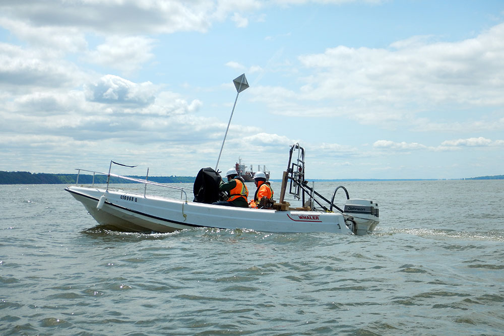
MARINE GEOPHYSICS
Sea bed imagery
Sub-bottom geological profiling
Shear wave velocity measurements
(marine MASW)
Submerged infrastructure investigations
Marine construction projects and port development
Dredging monitoring and control
Dam site investigations
GEOPHYSICAL METHODS
- Seismic reflection
- Seismic refraction
- MASW
- Hydro-Tisar
- Electrical resistivity / IP / SP
- Electromagnetic methods
- Magnetometry and Gravimetry
- Gamma-ray spectrometry
- Ground Penetrating Radar
- Vibration and noise monitoring
- Marine seismic profiling
- Borehole logging
- Side-scan sonar
- Multi-beam and SWATH bathymetry
GEOPHYSICAL EQUIPMENT SALES AND RENTAL
- New and used equipment